Savannah, 1940
I made this map using Social Explorer. The shading indicates the relative percentage of homeowners in each tract who were African American, while the labels show the numbers of African-American homeowners per tract. (Click on the image to see the figures in more detail.)

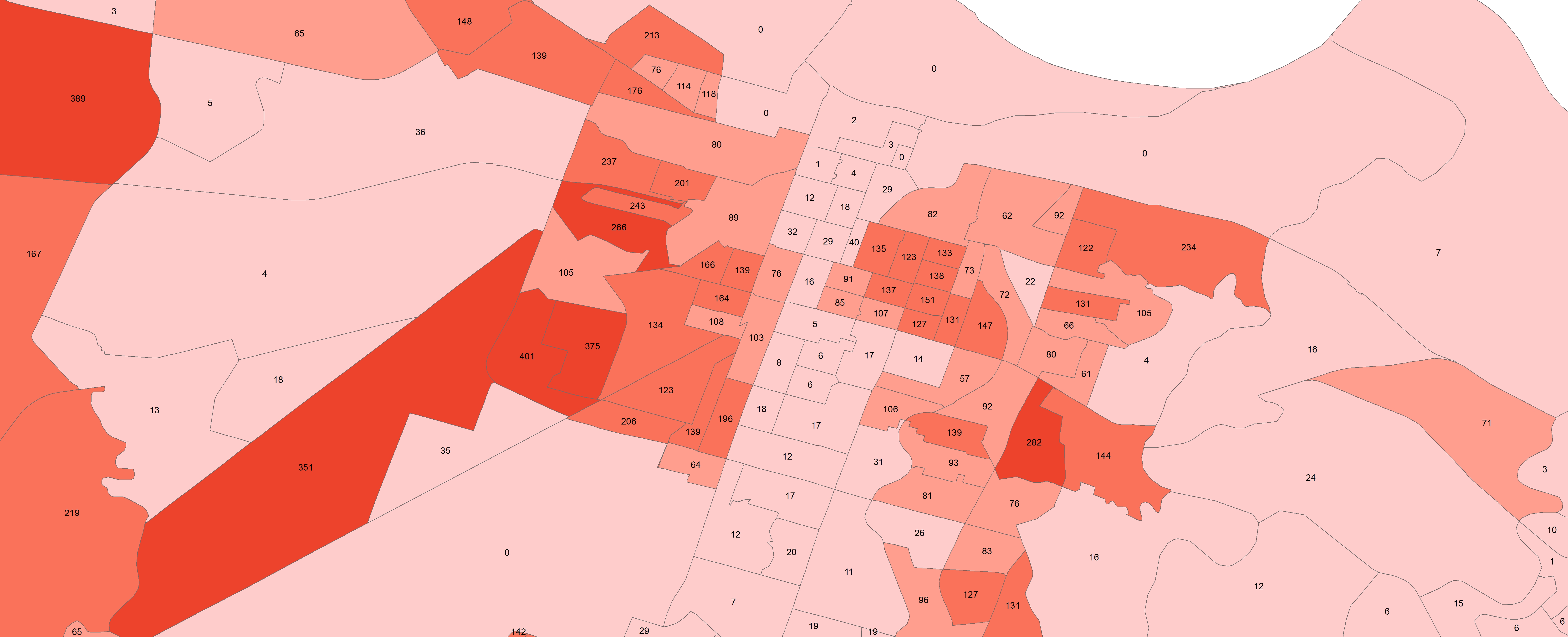
Savannah, 1970
To create this map I used the PDF 1970 Housing Block Data for Savannah to create a spreadsheet. The census reported the percent of homeowners in each tract who were African American, so I calculated an estimated number of individual African-American homeowners. Then I joined the spreadsheet to the 1970 census tract shapefile from NHGIS. (click to see in detail the numbers of African-American homeowners per census tract)
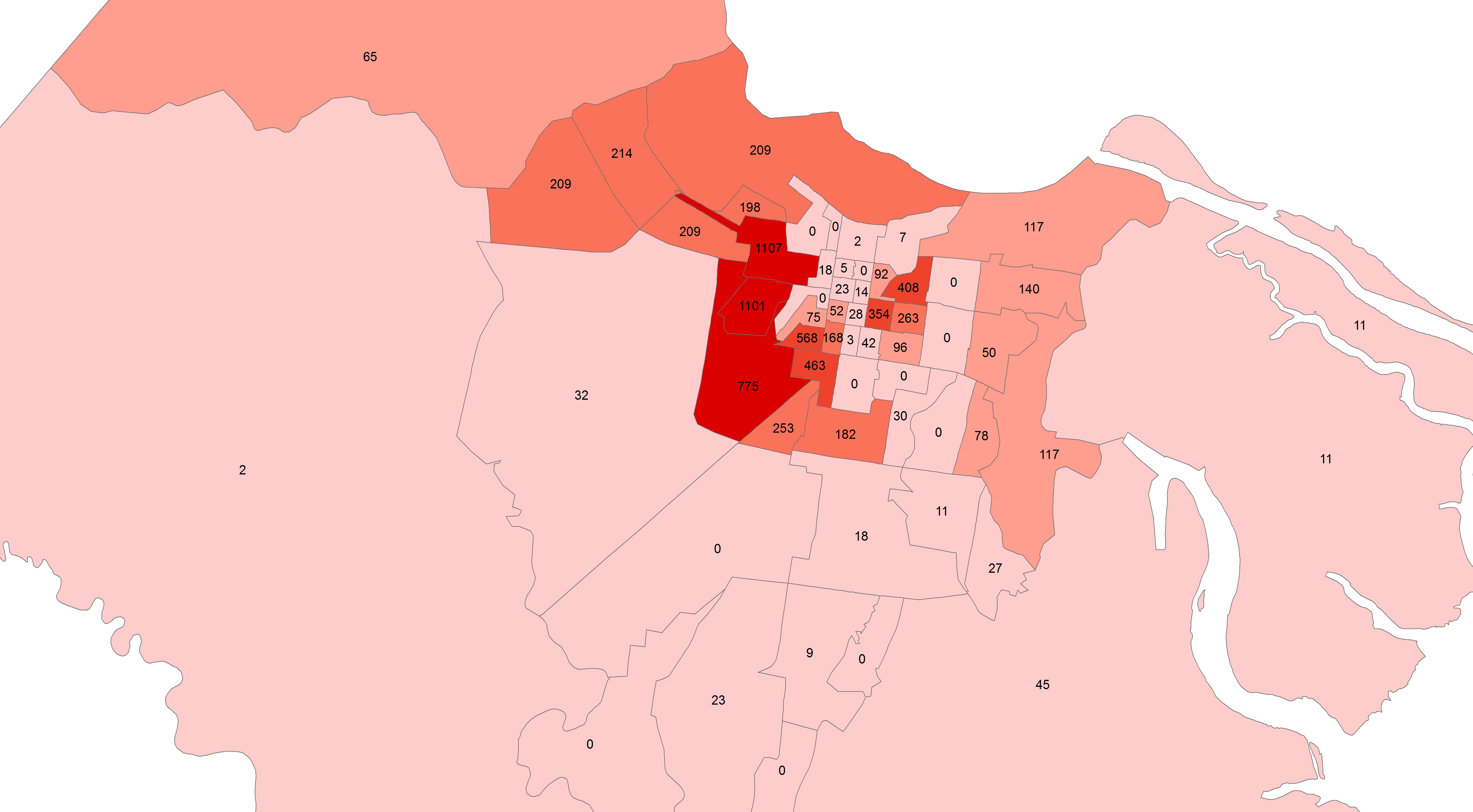
Savannah, 2013
To create this map of African-American homeownership in Savannah, I used the data from the 2013 Chatham County Block Group data from American Fact Finder. You can also make a similar map on their website. (Click on the figure to see the information more clearly.)
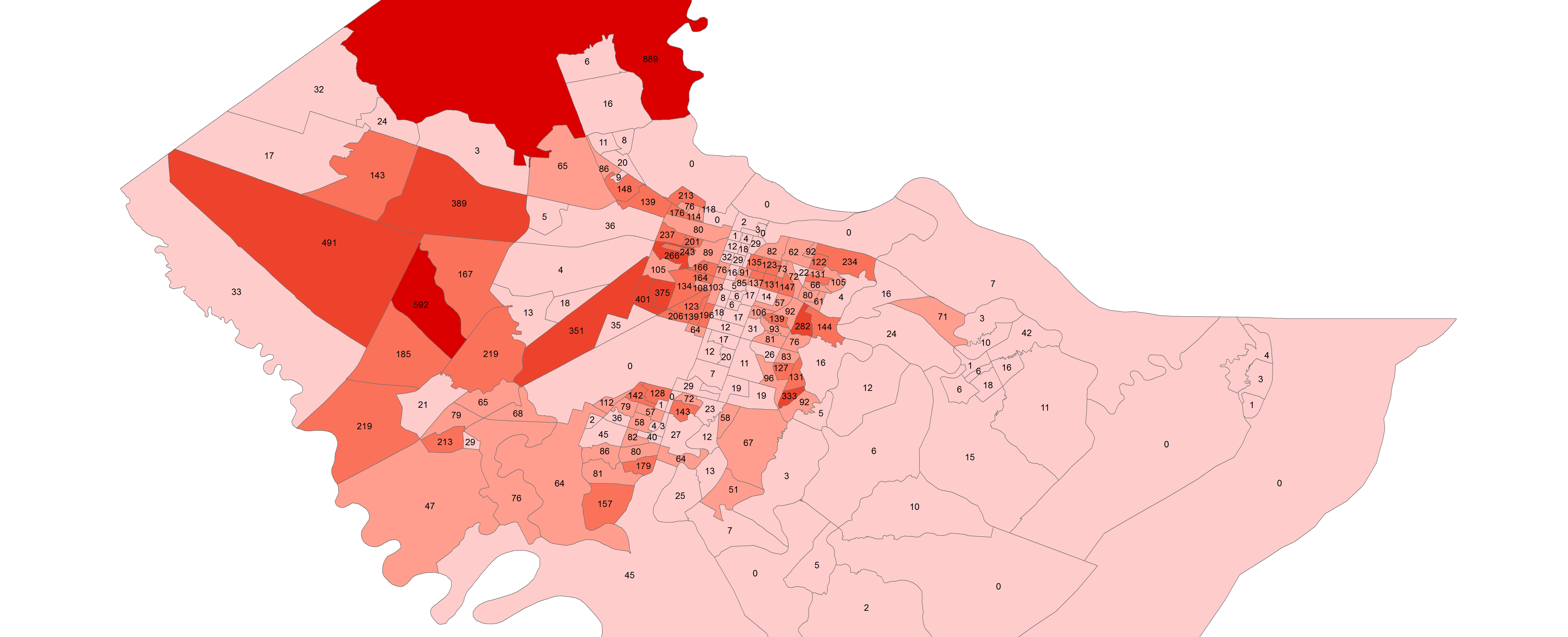
Closeup of the Downtown Area, Savannah, 2013